
The Bicycle Network web pages have mentioned new/proposed trail infrastructure that may help my March “Edge of the World” ride. So I decided to take a look.
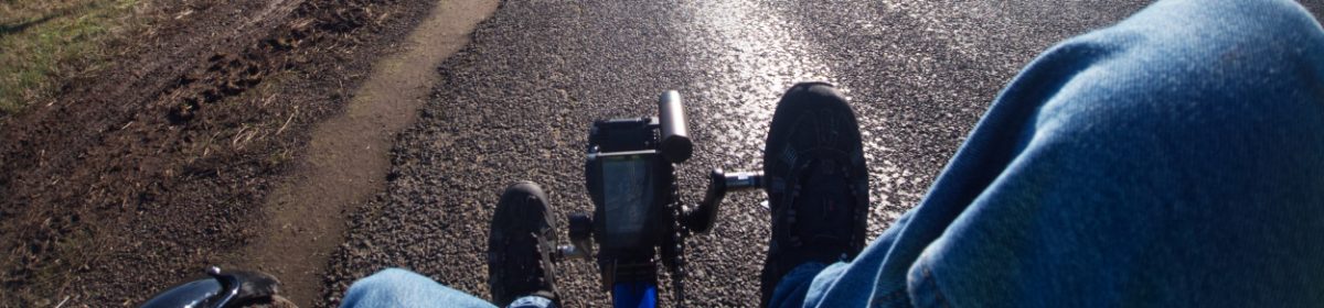
Before getting on with the story though, I have been “fixing” the mountain drive on Brompton this week. The bike had been making a series of grating noises as the pedals went round. On checking I found it was not the pedals, not the chain, not the derailleur, not the frame joints and not the suspension. Bugger; must be the drive itself.
It had become loose, the insert holding it in the bottom bracket should be tightened to 100 nm but it had started to thread itself out! How was the drive still working without slipping? Luckily I had all the tools to address this after working on Ernies mountain drive. In with the special cylinder to protect the gear change rod, off with the crank, on with the special socket and it was soon tightened back up – as tight as I can get it – change button back on and tightened with the special holding tool and 1.5mm Allen key. Test ride – Oh dear, still grating, just not as much. I had also bought tubes of the special (ly expensive) grease sold by Schlumpf, so I squirted some in. Grating noise reduced. More grease, a bit less grate. Another, larger, squirt and the tube was empty. The bike was loaded into the car.
I decided to drive via the route from Deloraine to Latrobe which I intend to take when cycling the tour and which, I believe, will keep me off the Bass Highway as much as possible. That went well, cruising slowly through country lanes heading to Kimberley. There I moved onto smaller country roads through the Mersey River valley. All good for triking except the country did get hillier the closer one gets to Sassafras. One downhill looks good for the trike, going north anyway, so looking forward to that one!

There is a link to Latrobe from the road I drove, running off east, taking in part of the Tasmanian Trail. It is shown on the above map by the hatched bit. I was unable to locate the southern end as I drove along and so went into Latrobe by main road to find the northern end of the Trail which is along the Deloraine Old Road.
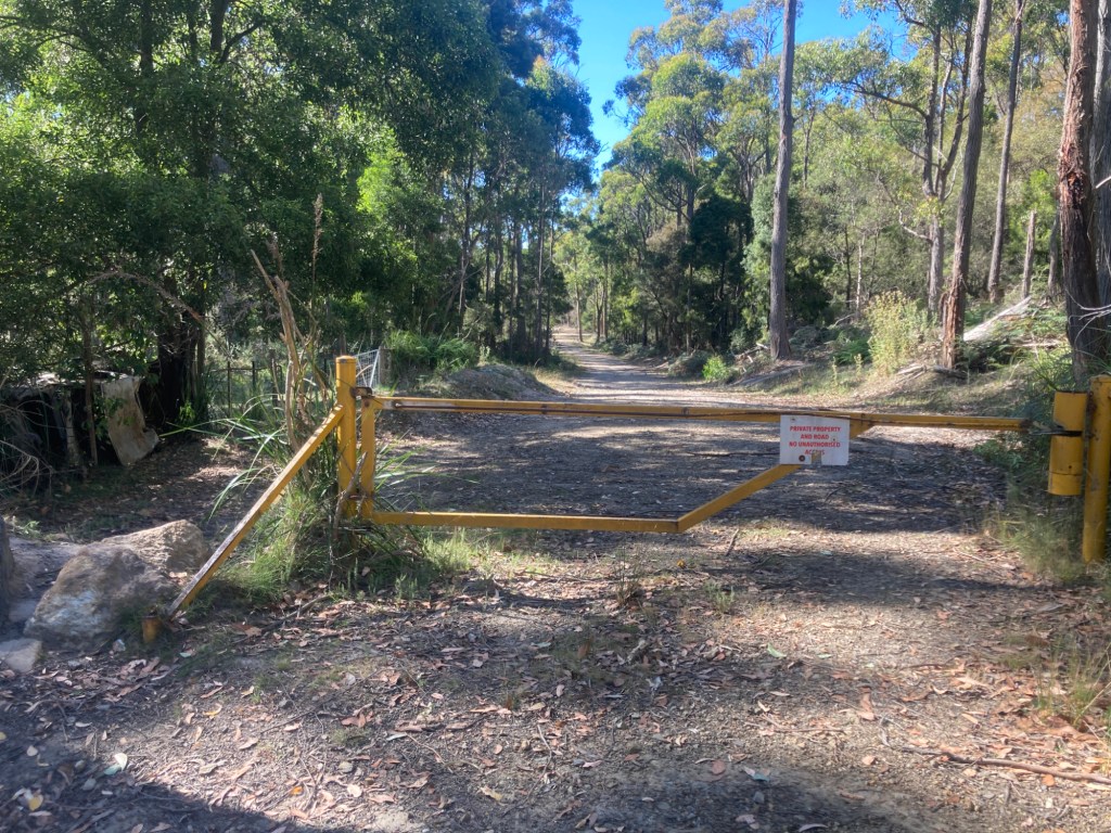
It starts here, at this gate. There is nothing advertising it as part of the Tasmanian Trail and the only signs present state it is private property. I would probably be able to get the trike under the righthand side of the gate – may need to take the seat off. Hmm. Think I’ll save this for a later explore as Colin will be with me on this part of the Edge of The World trip so maybe best to just cycle up to Sassafras and head down the Bass Highway for 4-5 kilometers to run into Latrobe that way.
Having found out what I could at Latrobe, I drove on to Devonport and got Brompton out of the boot at the Bluff. There is a new bridge on an extension to the shared path and I took off to find it. I didn’t know if the bridge was actually complete yet or if it would be of any assistance if it was open.

It was a lovely day, 24-25°C, no humidity, sea breeze and a blue sky. I set off west from the Bluff following the shared path to Don. At this point the trail parallels Bass Strait.

The trail runs through some atmospheric Paperbark groves before getting to a car park. Normally I take the left trail here and climb up to Don College but this day the idea was to go through the car park and see if a new trail comes out the end. It did. A bit of rough gravel and then onto a better gravel surface which, in turn, led down to the new bridge.
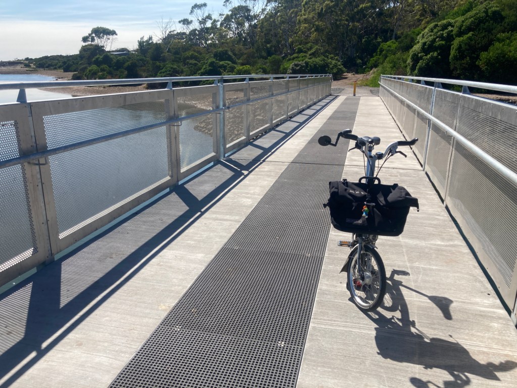
OK, it is open and it crosses the Don river. But Why?
To answer that I rode across and then headed towards Don. It was uphill away from the river and there were no shared paths. I was able to test out the mountain drive in low range and slowly climbed the hill away from the river. Ride with GPS shows maximum gradient as 12.8% and it certainly seemed that way as I wobbled up at around 4kph keeping breathing and heart pounding along at a non life-threatening rate. There was no grating to be heard from Brompton or me.
At the top I still couldn’t really see the purpose of the new bridge. One road takes you down to the Bass Highway while the other descends and returns you to the trails around Don via another bridge.

I chose the track down to the second bridge and, once at the bottom, it was was great. The warm air brought out bush smells along the track , the air was full of eucalyptus oiliness and everything smelt, well, bushy. Ah, the smell of Australia.
Across the bridge the trail kicked up so much I had to walk.

It crossed the Don River Railway line – a track used by the privately operated tourist railway – and then led up to Don College. I continued to walk as it was steep. A young woman was walking up behind, then alongside and then in front of me as I pushed. At the top we looked at each other. “Quite a climb?” I offered. “Yes” she said, “I’m bloody knackered after that!” before striding off.
From this point I cycled the trails back to the Bluff. At one point a couple of guys on e-bikes pushed past with no warning. I just got a glimpse in the mirror as the first one shot past. “Forgot your Bell?” I asked. Got no response.
On to Turners Beach for the last thing to be checked out. The land between Don and Leith near Turners Beach is unknown to me and I wondered if there was any way of cycling between the two without using the Bass Highway. OK – it seems there is no road or trail link. There is the Bass Highway, then farmland, then Bass Strait and nothing else for quite some way.
Any hopes of finding a non-highway way from Don to Turners Beach other than via Forth were dashed.
Still, there was an underpass under the road bridge that links Leith and Turners Beach to be found. Apparently recent works to put in a shared path had re-discovered this but where was it?

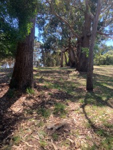
I had lunch at this delightful spot. The Forth River to the left, bush to the right and a table all to myself with the bridge upriver in view.
After lunch I walked down to the road bridge which, legend has it, a forgotten underpass runs underneath.

Or, rather, I tried to walk to the bridge. This tidal inlet is in the way! I don’t think there could be any idea of running a shared path down this side into Turners Beach.
Then I visited the other side of the river to try there. Looking at the projected plans it would seem a shared path will be installed along this bit of crown land. Currently the people living alongside the river are using the Crown Land pretty much as an extension to their gardens so maybe a bit of a battle lies ahead. Many houses had signs outside saying “Protect Leith” or similar so they must want to keep their current lifestyle. From walkers and cyclists or other changes in the air?
Anyway, initially I walked on the shore as the status of the grassy top of the river bank was unclear until I quizzed a woman walking past. She confirmed there is a stretch of crown land up there. On it are some magnificent old (thick-trunked) gum trees. Plenty of heavy overhanging branches to drop too so a shared path near them would need tree surgeon activity to keep it safe.

Getting to the bridge I realised there are more than one. In total three span the Forth River at this point. The furthest one is the road bridge, the middle is a new rail bridge while the nearest looks very much like the old railway bridge that has had work started on it to become a shared path.

I believe some funding to help the proposed Latrobe to Wynyard shared path get over the river has fallen through – so work has stopped. Quite where the underpass is I don’t know.

I climbed up to be level with the railway track but there was no access at that point. There was no easy way to get down to the shore and walk under the bridges either. So I left.
Summing up.
A good day. Found out a few things and have decided the route to travel both Deloraine to Devonport and then Devonport to Ulverstone.
Mountain Drive still creaks a bit but much less than before. A bit more grease needed?
’til next time ………………..

I wonder if we will ever find that underpass? And trails galore to explore. One could spend a week triking, between Penguin and Devonport and not ride the same trail twice
Reconnaissance with a ” mystery ” exciting blog can’t wait till the next chapter,
LikeLiked by 1 person
Your post reads like a mystery story, but sounds like it was fun to get out exploring (especially in nice weather!). Protect Leith – once you let the cyclists and walkers in, the soy latte sippers follow, and it’s all downhill from there, except property prices. Lol.
LikeLiked by 1 person