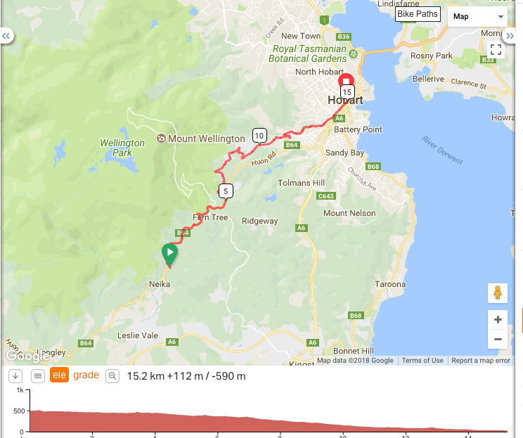
Instead of a trip from the summit of Mount Wellington I compromised and went to Nieka. This ride will be the last of this series in southern Tasmania and the first of my Cyce Life Challenge.
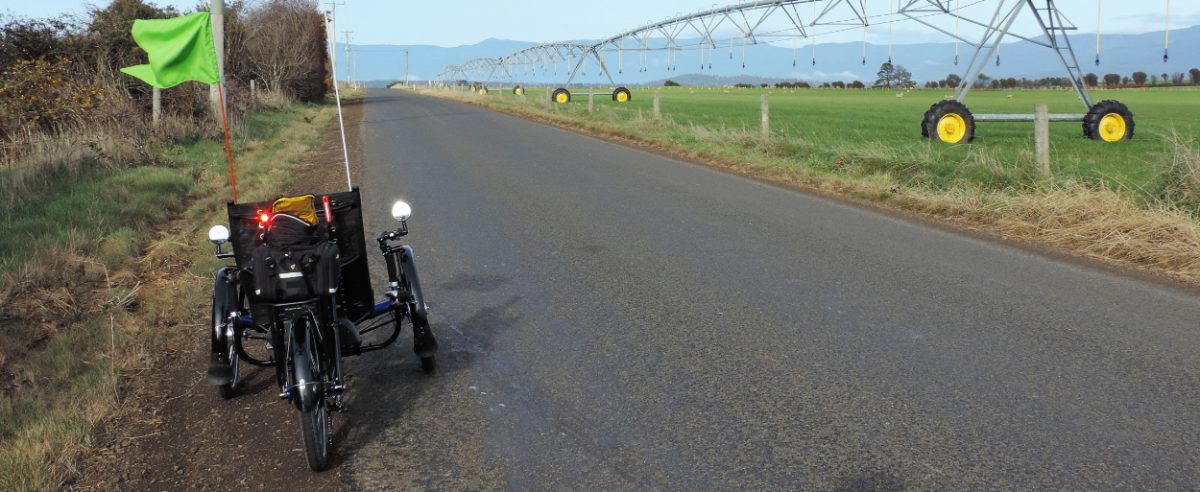
We arrived at Nieka; I unfolded Brommie and went to pick up the camera. What do you know? The SD card for BOTH cameras are back at Howden after I took them out to load pictures into the laptop last night! Never mind, I have the fall-back ‘phone in the camera – I think.

The top of the road. This cyclist was one of a large group pushing heavily for the crest. There was little breathe left to acknowledge an odd looking cyclist waiting to set off from the top. As you can see, the day was another top day.
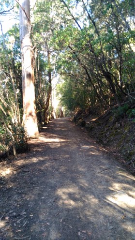
When we arrived in Tasmania in the mid-80’s the trails on kunanyi / Mount Wellington were only for walkers. Then a few were opened up to cyclists and now, it seems, bikes are acceptable anywhere. The Pipeline Track and the track down to Fern Tree running from Nieka are linked to the Hobart water system infrastructure. Nowadays water is also drawn from the River Derwent but in the early days – this was the only water supply.
On tracks like this there are all sorts of hardware off to the sides piping water down into the Waterworks Reserve used to service Hobart. Today I began by rolling down the “Old” Huon Highway enjoying the views of kunanyi from the road. After the ’67 bushfires many large gum trees on the mountain were killed off by the extreme heat generated. In the 80’s we could see many of those trees standing out with their stark white barks and limbs with no leaves. They are known as “Stags”. Today the regrowth has hidden most of the Stags and, I assume, a number have now fallen down. So the view is of a sea of green up to the altitude at which no trees will grow. At Strickland Avenue I turned off.
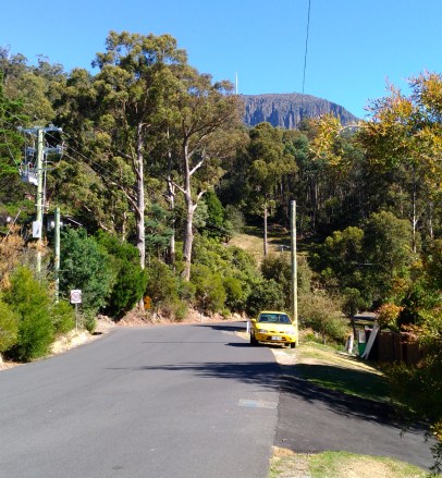
The view is of the start of Strickland Avenue. Mt Wellington (1271 metres) is in the background and the white tower on top holds TV broadcasting equipment. There are two towers and they used to be one for the national broadcaster and one for commercial TV. I don’t know if that remains true. I continued to roll – down Strickland Ave.
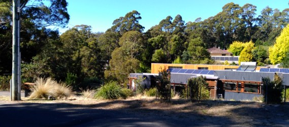
There are many homes snuggled into the bush off the Avenue. It is a delightful place to live and so close to Hobart. It would be a nightmare in a bushfire though.
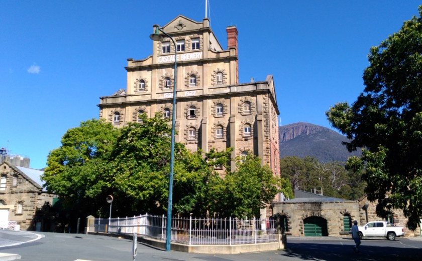
The road runs down to the Cascades Brewery. The Brewery was established in 1824 using the clean waters coming off Mt Wellington. It is now Australia’s oldest Brewery. The complex includes cafes and gardens as well as offering tours of the Brewery. From the gardens runs a shared walk/cycle track along the Hobart Rivulet through what is now called the Hobart Linear Park. That is my route today.
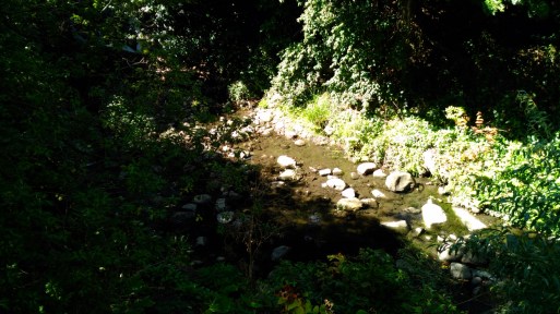
The Rivulet just below Cascades. A bit dry at the moment as we haven’t had a lot of rain.
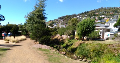
A typical view of South Hobart showing houses up close to the Rivulet. In the winter parts of the track are in the shade most of the day and it is not unknown for frost to lie all day.
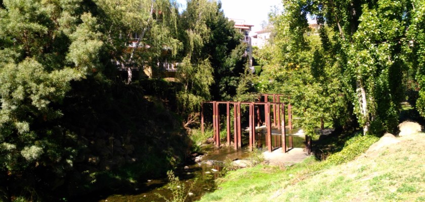
In the early days the Rivulet was also used to power water wheels and drive industry. These metal posts date back to the 1800s. The buildings that can be seen through the trees is part of a very expensive retirement set-up. Not one we will be living in.

The track ends about 2 blocks from the centre of Hobart. In the ’67 fires, the bush around the Rivulet was a conductor of fire almost into the city. Here the Rivulet remains sort of in it’s natural state but soon it becomes a concrete channel in the interests of health and hygiene.
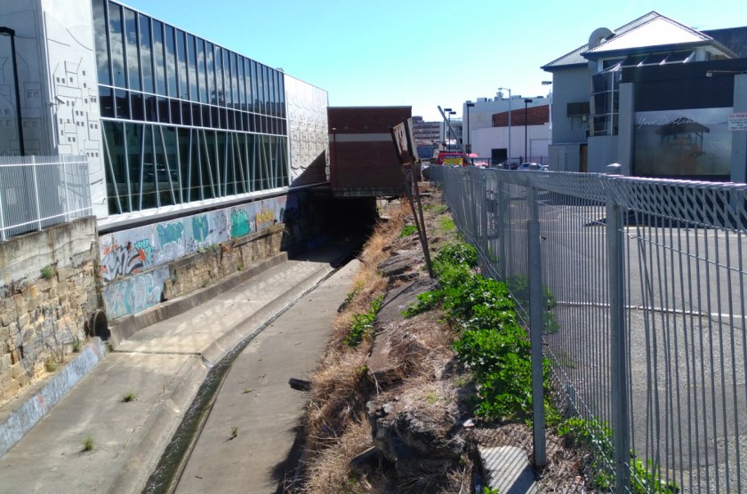
Soon the Rivulet goes underground as roads and businesses take over the surface. I have met people who have taken a lilo trip down the Rivulet through the tunnels under the city and out past the Hospital during a high water flow condition. I believe this is now impossible due to “improvements” (read controls) to the route.

In the city symbols like this identify where the Rivulet flows underneath. I have tried in the past to find out exactly where it pops out into the docks – and where it originally exited. I failed on both counts.
Now it was time to support the local Community.

Purchase 1. A coffee of course.
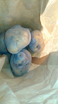
Purchase 2. From the Brisbane Street Farmer’s Market I bought a kilo or two of South Arm Pink Eye potatoes. Well, they were from Fawcett but that’s close enough to South Arm. Pink Eyes in the supermarkets are a poor facsimile to the “real stuff” from the Arm.
That completes Ride #1 of the Challenge.
Total for week : 118 k Total for year : 1,133 k
Vivente : 27 k Brompton : 91 k

Great work Tony! I’ve never descended Strickland, always choosing to continue down the Huon Highway into Hobart. That’s fun but stupidly fast at points.
I’m going to try and grow my own Pink Eye potatoes, so delicious!!
LikeLiked by 1 person
Wonderful stuff yet again Tony. Great info always interesting, well done with assisting the community with your purchases-very discerning!
LikeLiked by 1 person