To begin :
Monday opened after the warmest overnight temp for some years. To our north, Melbourne had a minimum of 28°C while we had 24°C overnight with high(ish) humidity to get us started. I rode an extended Bishopsbourne Road loop out of Longford (20k) and then had a welcome cool shower. On the road were hundreds of dead dragonflies. Maybe the warm night drove them into an orgiastic frenzy and they were now paying the price!
Tuesday on the other hand opened with 10°C after a wet night. I was busy harvesting our parsnips which have started to shoot, so that took the morning. After that I took a short tour around Longford on the B. So far, not far. I visited the boat ramp (View the ramp) and found piles of rubbish squashed down between large rocks. It was mostly soft-drink cans, and bottles and fast food containers. As I cleaned the mess up, carting it up the ramp to the bins at the top, I was hatching a plan to get away for a couple of days/nights. After Tuesday the weather should be cooler – crikey the BOM (Bureau of Meteorology) is even predicting a chance of frost on Thursday night! It might be an idea to pack the big sleeping bag – where has summer gone all of a sudden.
Off to Deloraine
Thursday I hit the road for Deloraine complete with all the camping gear extracted from the dark places in the laundry cupboards. I also tracked the ride using Ride with GPS.

In previous years I have cycled to Deloraine but always using the Meander Valley Highway. This time I am travelling on the backroads through Bracknell and Osmaston. It will be a bit hillier but quieter traffic-wise.
The weather was perfect as I left home. Sunny, cool and very little wind. In the street were two blokes wearing yellow jackets delving into our neighbour’s recycling bin – the bins were out for emptying. I saw we had a green sticker on ours and they were just attaching a red sticker to the neighbour’s bin! She had transgresses a recycling law and been caught out by Council bin snifters! Another bin close by had a orange sticker on it – haven’t yet found out what that means. That must be a really interesting job taking you up to your armpits in recycling and checking out what people have been up to. “Oh look – an empty bottle of Grange – they must be rich!” or “Aha, trying to sneak green waste into the bin – can’t have that”. Let’s get going.
On the ride today there were, again, dragonflies but this time they were all flying and showing off their extreme manoeuvrability. Half a dozen or so suddenly flew down the road around my head like an escort – for 20 to 30 seconds I had my own personal helicopter gunship protection squad. Then they went into “anything goes” mode once more. A Scottish Shepherd wrote in a book I read recently that dragonflies can achieve speeds of up to 90 mph. Not quite sure about this I checked Wikipedia. W reckons modern testing shows they top out at around 30-35mph! That’s still quicker than I can cycle.
Although we had a bit of rain early in the week, the countryside remains dry and mostly straw coloured with patches of green where irrigation is being used to grow crops. In recent years most irrigation systems have been changed to use the “pivot” method – a long train of connected mobile sprinkler units pivoting round a central “boss” formed by a very large lump of concrete. The system creates large “Crop Circles” which are not the same as those made in European fields by people (or aliens!) flattening crops thus forming complex patterns. I am told that when flying down to Hobart, the Tassie countryside can be seen to be covered with green crop circles amid the brown land.
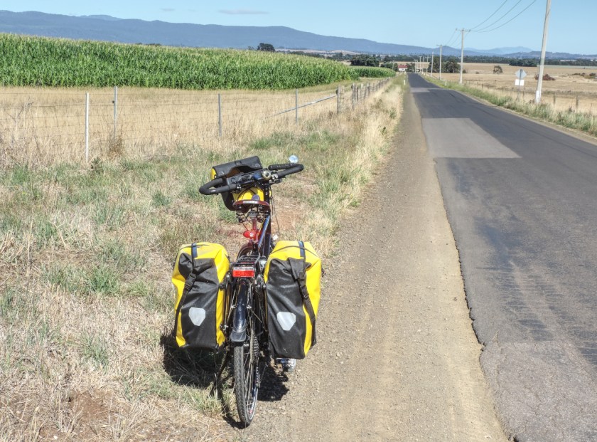
Sweet Corn crop circle. Quiet road and no wind = a very pleasant ride
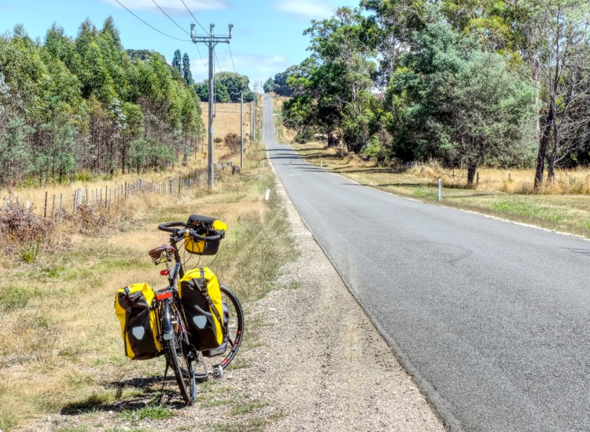
I left Longford by riding Wilmore’s Lane across to Bishopsbourne Road. This involves climbing 4 small but sharp hills. When bushwalking from Kanangra Walls to Katoomba in the Blue Mountains (NSW), the track starts rising by climbing 4 hills – named Rip, Rack, Roar and Rumble which in turn lead to Mt Cloudmaker. I think of the Wilmore’s Lane hills as another version of R,R,R and Rumble. Rumble is particularly apt because recent chip seal work has left the road with a very bumpy surface! While climbing the hills today I reacquainted myself with the way to ride a touring bike laden with 4 panniers and probably too much gear. It certainly rides differently and actually feels much better over the crap chip seal than an unladen bike.
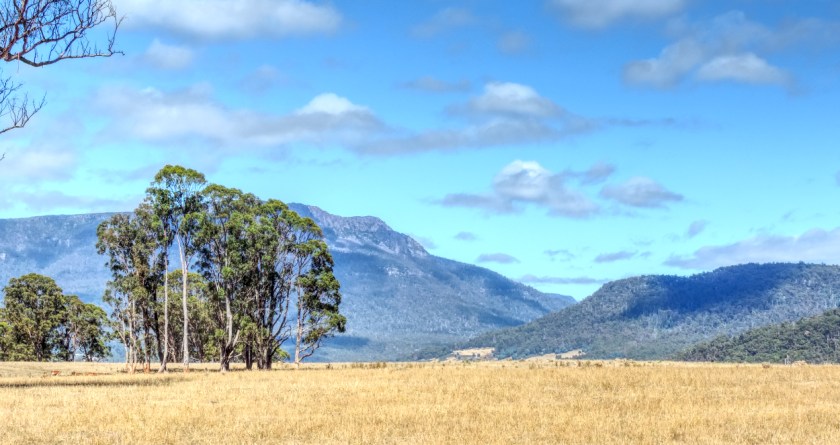
On the way out of Bracknell. The valley between the ranges is the road to Liffey Falls.
Bishopsbourne passed quickly and soon the distance to Bracknell was done in good time. I called in at the overnight camp area by the Liffey River to see what was happening. Had to pull over on the access track as a “camper van” was coming out. It comprised a flat-bed truck with large dune buggy and middle-sized SUV on the tray towing a double-axle caravan. The rig also included bicycles and canoes attached a various points. What a setup. I didn’t even get a “thank you” wave for pulling over – obviously not worth worrying about.
After a chat with a nice lady from Lismore I pressed on. Through Bracknell I recalled that all street names in this town were female names – this dates back to the early 1870s when the town was laid out. From there it was down to the start of Cluan Road. No traffic to speak of which was nice and not a soul seen in Bracknell after the camping area, which was eerie. After a gentle introduction, the Cluan Road gets a bit hillier and the longer it goes on the more hills are squeezed in. They are not long but they kick up near the top creating crests over which oncoming traffic cannot be seen. Four hills have this feature. For the first 3, cars came up behind me as I got close to the top. They hung back and eventually I could see over the top and waved them through. The fourth hill and a white Ute with yellow lights on top rapidly approached. He could obviously tell the road was empty on the other side because they just pulled into the oncoming “lane” and drove straight over the top! I envy the driver his/her ESP powers.
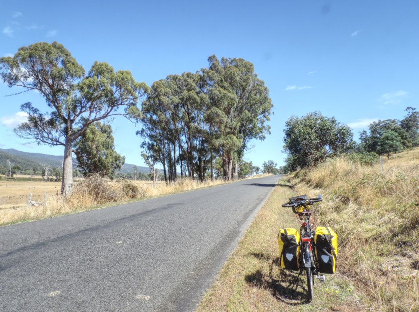
The first gentle incline along Cluan Road. Still not much traffic

Looking back across “Savanna”. The Tiers impressive today.
The second feature of the hilly bits of Cluan Road was the dead wildlife scattered all around. Lots of it. All sorts of bits and pieces burst out of their skin – looked like scenes from one of the battle scenes from Game of Thrones or one of the more gruesome “ScandiNoir” TV series. Each carcass had it’s own aroma and family of flies. Normally there would be Ravens ripping into them but today, not a Raven to be seen.
Eventually I popped out of Cluan Road and turned left onto Osmaston Road. It was time to stop, input some water and renew sunscreen. Although the day was cool(ish), the sun is still a summer sun and likes to burn. Visitors to Tassie are often caught by the fact that UV rays have little to do with how hot the day is. A cool day, clear sky and a cool breeze in the middle of summer makes them think sun screen is unnecessary – which is generally a painful mistake.
Heartbreak Hill. Once again the camera doesn’t really depict the climb.
At Osmaston (which is a road junction rather than a small town) I decided to keep on Osmaston Road and climb “Heartbreak Hill” again rather than turning for Exton and tackling the several hills that route involves. I felt like one big hill and not several smaller ones. H H was harder with the load onboard. I made it up the steepest part but then had to stop due to Asthma related wheezing coming from me. I decided to walk/push the bike up the next bit so as to keep moving and let things inside settle down, eventually arriving at a patch of shade which was most welcome. After that things were much easier and the bike and I soon hit the downhill to the Meander River arriving opposite the caravan park.
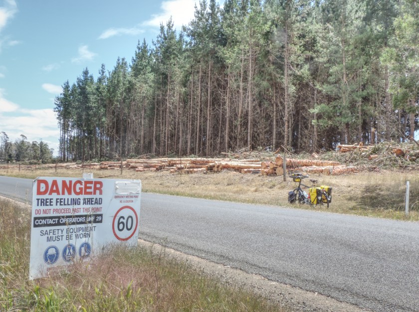
After The Hill I came across a logging site. I read the sign. Don’t have a CB radio so just cycled through
Walking along some tracks and over the river I had soon booked a tent site for the night up alongside the railway. The spots down by the river were filled by fruit pickers who had created a little “village” with their dome tents and tarps on sticks. After pitching my tent and stuffing all panniers inside I headed off for a coffee at “Field Rabbit” who produce one of the best brews in the town.
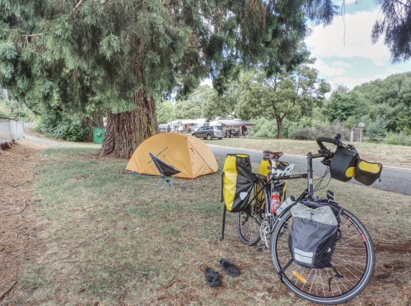
Campsite between the railway and the Meander River
Friday. At the Deloraine camping grounds one’s sleep is broken by passing goods trains. The engines have to hoot at every road/rail crossing and there are 5 crossings though Deloraine. One is the entry to the caravan park! As my tent was approx 10 metres from the track it sounded like each train was actually driving through the tent. There were 5 (I counted) sleep interruptions. For four I managed to drop off again quickly but the train at 2.30am caused me to lose an hour. Just could not get back to sleep so I read my book for a while until reaching the sleep drop off point again.
Up, packed and breakfasted by 9am I met up with the PoWs (People on Wheels) and we cycled River Road. It was a bit harder with all my panniers attached and the PoWs looked on with amusement.
Back to Deloraine and to the Deloraine Deli for lunch where Sue and I met up and I got a lift back home after visiting the In-Laws.
After the camp trip the remaining days involved only short rides around Longford to bring the week to a close.
Total for week : 106k Total for year : 471k
Vivente : 92 k Brompton : 14 k

2 thoughts on “Week 5, 2018, including an overnight Deloraine cycle/camp.”