
For some weeks now the weather radar has looked a bit like this.

Clouds and rain all over together with high winds. One day the 7 day forecast appeared to show a break in the weather over the coming weekend, so Colin and I took our trikes to Somerset on the NW coast.
Our intention was to ride newly completed legs of the NW Coastal Trail. I have written about this trail before but will do a quick recap. 10-11 years ago the Councils across the NW coast got together to plan a shared walking and cycling pathway to run some 110 kilometres from Latrobe in the east to Wynyard in the west. Gradually sections are constructed and come into use and we have ridden the eastern sections between Latrobe and Ulverstone several times. New sections between Wynyard and Burnie have recently been completed so it was time to go and ride them.
As I said, we have been having some pretty terrible Spring weather recently and we had our fingers crossed we would be able to get this weekend in. We drove up on Friday through wind and showers and, during pitching tents, we fought a strong sea “breeze”. It tried to turn our tents into kites but we won and got them pegged down.
It rained overnight and Saturday morning found everything damp but the sky was almost sunny. The tents were dripping on the outside and the inside of my flysheet was also soaked from condensation but it had kept the inner tent, me and my sleeping bag dry. Having retired early to get out of the cold wind, it had been a long 10 hours in the tent when I arose about 6am.
Disaster. On the way to make coffee I dropped the grinder. The outer case was OK but the ceramic burrs inside disintegrated when I turned the handle. Bits of coffee intermingled with ceramic burr bits was not really drinkable! Luckily I had a few teabags but it just wasn’t the same.
Anyway – soon it was time to ride !!
Ride 1. Somerset to Fossil Bluff

We peeled back the damp trailer cover and unloaded the trikes. They were dry. Colin had charged his battery the previous evening and mine was ready, charged at home. We loaded on the bags with spares, toolkits, puncture outfits, wet weather gear and cameras and set off.
Where were we going? Today our plan was to ride the Wynyard leg and we would test the Burnie part tomorrow. So far the weather was playing ball.
We cycled out of the caravan park, crossed the busy coastal highway and climbed onto the Coastal Pathway turning left, (west) to head towards Wynyard. The ride was slow as we were cycling into a headwind. The air gradually got colder too and I soon dug out some warm gloves.

The new trail was excellent being smooth asphalt and wide. There were a few cyclists (in lycra!) and rugged-up walkers out and about even if some were walking their dogs. No, seriously, all dog walkers made sure we could pass OK and it was great to see the pathway in action on a Saturday morning.
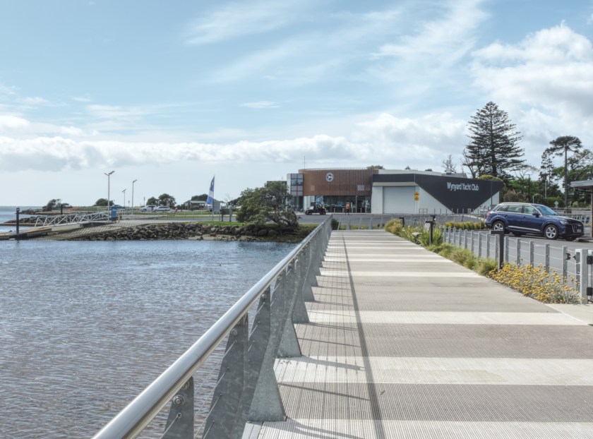
Wynyard is a rural town with a population of approx 6,300 people situated on the Inglis River. It works for the surrounding rural area acting as a service hub. It once was a busy port but that work was taken over by Burnie in the 20th Century. Today it is a friendly, good looking town with well manicured parks and gardens with some interesting geological features nearby.

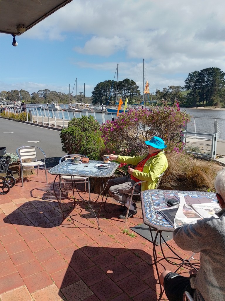
Just after the Wynyard wharf and Yacht Club we spotted an accommodation business with restaurant attached that also provides coffee and muffins to passers by. So we stopped and partook of the fare. Very nice it was too.


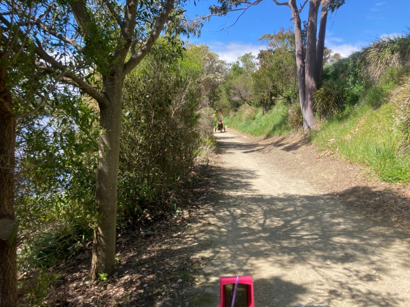
Then we continued up to Gutteridge Gardens through which the pathway, in a gravel form, now continues to Fossil Bluff. Some really nice sections had us riding between the Inglis river with it’s remnant bush and established gardens on the other side. In places the trail was a bit bumpy for trikes and some of the steeper bits had the back wheels spinning but the views made it worthwhile.

The view from Fossil Beach to the Cape looked really good as the sun was out, the sea was blue and the sky hosted fluffy white clouds. Good enough for a chocolate box if the image was framed correctly.

There is quite some geology here and good signage explained what had gone on when glaciers ruled.

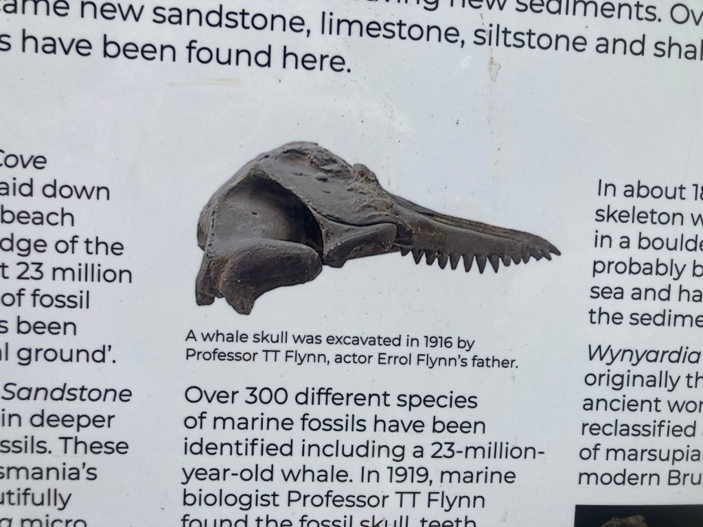
Of interest and as noted on the sign, Professor TT Flynn was Errol’s father.
The weather continued good on the return leg. At some point we saw another trike heading towards us.

It was a bloke called Pete on another Greenspeed. This time a GT20 tourer. His abilities impressed as he had built himself a sun canopy using parts from a broken outdoor chair. It was a sturdy canopy well mounted and (he said) a fitting that the wind doesn’t notice. That’s unlike my Veltop which the wind definitely notices.
It was a good ride and the trail is really good. It is mostly built on the old rail line that used to run Wynyard to Burnie. There are some points where it detours and it looks like it would have been hard to take the trail through a couple of the cuttings and that, in some places, future coastal erosion may be an issue near the rail line. The work has ended up with a smooth, wide path all the way from Somerset to Wynyard which is good news.

As we arrived back at Somerset the sea “breeze” started up and continued well into the evening so it was another early retirement to do some book reading.
Ride 2. Somerset to Burnie

We awoke to soaking flysheets, dry inner tents and grey skies threatening rain. I checked the weather forecast and we discussed what to do. Waiting until after breakfast, we decided to take the tents down now. It was likely to rain later in the day and we chose not to spend a third night in wet tents! Pack them up, go for the ride and then drive home was the choice.
With everything but the trikes packed away we cycled out to the Coastal Pathway again – this time turning right (east) to head to Burnie.
I didn’t take a lot of pictures on this ride. The weather was cool, the skies grey and I wasn’t in the mood! I had had a coffee (thanks Colin) but the change of plans and the general outlook had initially dampened my spirits. They rose as the ride progressed simply because the trail is just so good. Also there were a lot of people out and about too. Probably 66.6% of them either said “Hello” or responded to a “Hello” but the other 33.3% just averted their eyes and passed by. Incomers from the mainland, international visitors or just people who don’t like weirdos from Longford on outlandish trikes? Actually some may have just been surprised as Colin told me some responded to his greeting or to mine out of my hearing. Maybe I got the wrong end of the stick. …….
There has been much roadwork at the eastern end of Somerset. The bridge over the Cam river has been rebuilt and I was wondering how the trail would cross the river. No worries at all as it looks like the old railway bridge has been repurposed as a trail bridge. Nice and wide it allows an easy crossing.
Some works are still happening in the area and it was necessary to negotiate a bit off-track. No worries – it will be good when finished!
The next town to Somerset is Cooee and here the trail leaves the highway and sticks close to the coastline. Again, no problems. Then we run down into the Burnie outskirts.
Burnie is a port and an industrial city – the fourth largest city in Tasmania with a population of around 20,000. It is an important export port for the minerals excavated in Tasmania and used to have a huge pulp and paper mill plus a lot of heavy industry. Back in the Eighties, when we moved to Tassie, there was a long, long reddish slick going out to sea from Burnie caused by the waste from the production of titanium dioxide. Burnie was known as one of Tasmania’s most polluted towns and became the subject of Midnight Oil’s song “Burnie”.
Today, following the closure of the pulp and paper mill in 2010 and further industrial rationalisation the slick has gone and the city is changing to focus on healthcare, education and tourism together with a future in renewable energy and advanced manufacturing. This includes the development of the Marinus Link at nearby Heybridge which will be Tassie’s second undersea power cable to mainland Australia. The plan is that Tasmania’s hydro power together with new wind and solar power “farms” will use the link to assist Australia’s renewable energy goals.
So a lot of change for the town over the last few decades and more to come with the promise of employment in the renewables industry.
Back to today, the trail left the side of the highway and stayed near the coast. It runs past the footy club and then several new buildings that look severe and grey. One of them used to hold the Museum relating to paper making but now they have become the University of Tasmania’s UTAS Makers Technology and Innovation Hub. Then we headed down to the beachfront to join some existing pathways which have now been connected to become part of the Coastal Trail.
We cycled past the Surf Club. There was a lot of people here filling the pathway, rugged up against the wind and seemingly not pleased to have cyclists go past. Perhaps this is their front and the shared path runs behind the club? We couldn’t see it. Anyway, the trail continued onwards and we found ourselves in a cul-de-sac.
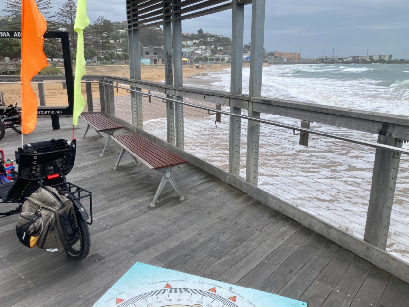
The picture is looking towards the Burnie seafront and, as you can see, it was grey and choppy out there.
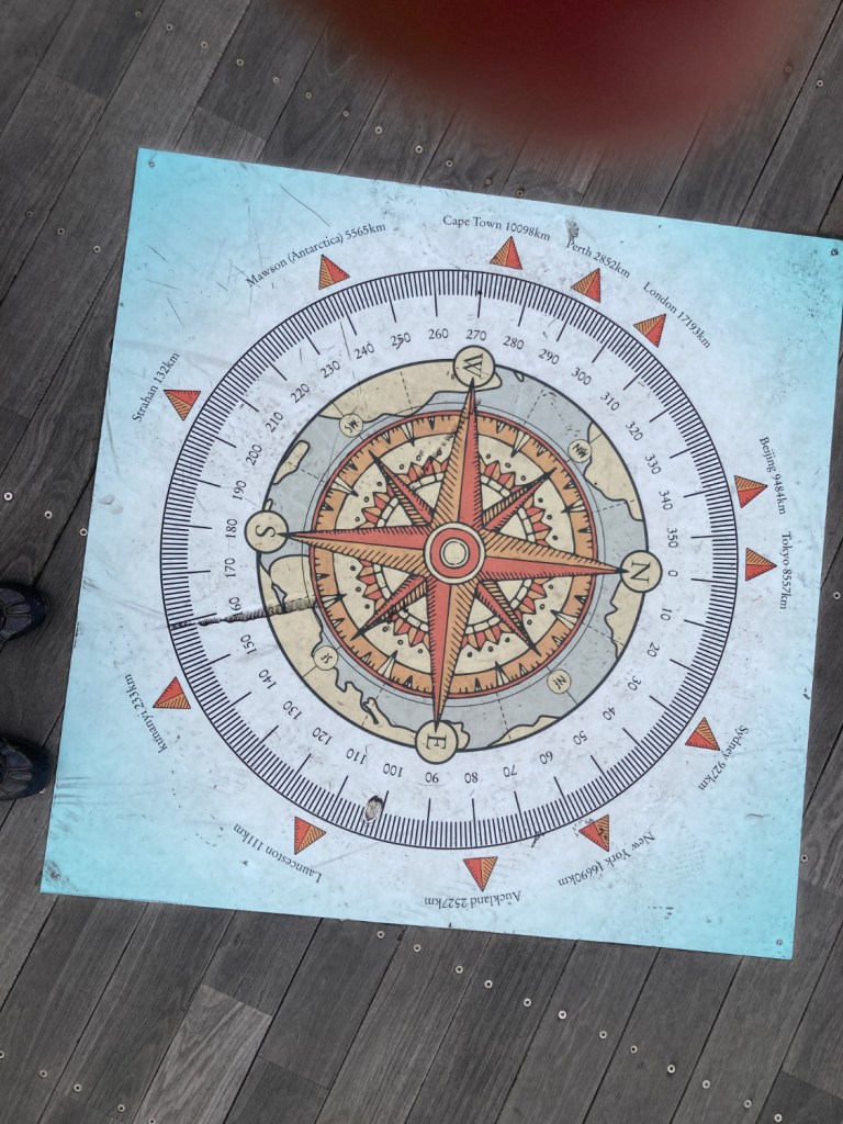
The places were an interesting mix. For locals and tourists there are a couple of Tassie place-names. For tourists it looks like a representative set of cities for the largest number of tourists. Beijing, Tokyo, Auckland, London, New York. Strange Seoul and Singapore don’t get a mention but Cape Town does.
It began to get a little drizzly so we continued. In some places I think the droplets in the air were actually spray from the surf where it hit rocks and went airbourne. We were keen to get as far as we could to the east before too much rain fell and then we could return to the surf club for a coffee in the attached cafe. The trail runs through a set of gardens sandwiched between the beach and the road to Devonport. There are old trees in the park and a variety of pine trees. The signage and sculptures were about paper making and it’s history in Burnie but we found no signs telling us about the trees.

The end of the trail led down to Training Ship Emu – a Naval Reserve facility at Wivenhoe Beach. On the road heading out was a set of traffic lights leading to the highway and no further Coastal Pathway could be seen. So we returned to the surf club cafe.
I didn’t envy the youngsters lying in rows on the beach being taught swim strokes (I think) by a surf club member. It was wet and windy and, judging that they were all wearing wetsuits, it would soon be time to get into the surf. Lucky them !!
We left them to it preferring to enjoy a coffee and cake.
I had plenty of power left in the battery and so, on the way back, when the track was clear, I enjoyed a speedy return. The track width and smooth surface with the lack of hills allowed a high cruising speed (for a trike) which brought a smile to the dial. I got so far ahead Colin was about to call to make sure I was OK as he hadn’t seen me for a while. Just as he decided to call he spotted me where I had stopped in a park to read some signs and wait for him.
We returned to the campsite and as we were loading the trikes into the trailer the rain began. All we needed was another 5 minutes of dryness!
Anyhow, we drove home having thoroughly enjoyed our weekend away. The trail lived up to expectations.
’til next time ………….

Hi Tony
So sorry to get a comment to you months later – I’m never able to leave a comment when I’m on my phone and have to wait and pull it up on my tablet. I guess I haven’t had the tablet out in a while. Lots and lots of things going on here.
You really made the most of the time and weather that you had on this ride and camping trip. It’s good to see new bits being linked up and the scenery is fabulous. Good on you for tenting it in crap weather, too.
It sounds like the rest of spring was more of the same. We have also had lots of windy days, but warm and dry here instead. I guess it all stems from the sudden stratospheric warming event? The one bright thing is that it has kept the flies off my face when walking home from work each day 🙂 I have often thought how glad I was not to be on a bike tour trying to head west, though.
Hope you and Sue have a very happy Christmas and New Year!
Emily
LikeLike
Yes we have had poor weather recently plus Sue and I had covid – so I am, at the moment, trying to pull enough words together for a final 2025 post. I should work it out before the 31st!
My cycling news, what little there is, should be on the Blog soon and for now I’ll just wish you the best Christmas and New Year then I will go and watch the start of the Sydney – Hobart !!
Tony
LikeLike